
- May 30, 2026
Residents and businesses now have new mapping tools to check out development in the area, capital projects and what swales are being worked on in the city of Palm Coast.
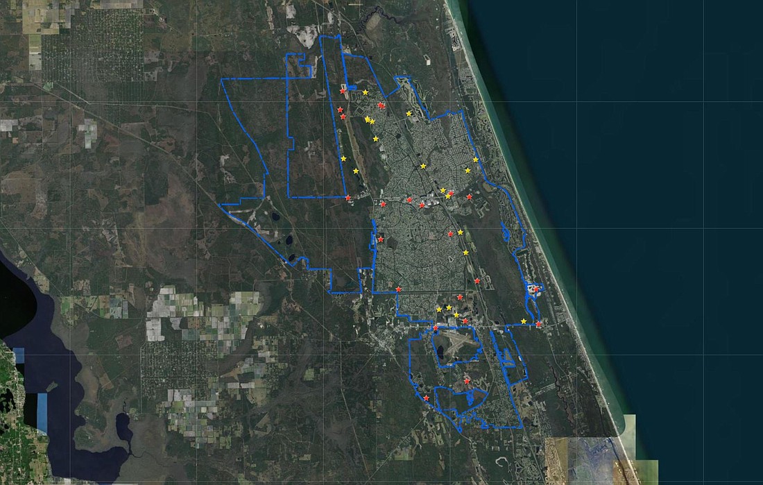
One of the maps shows projects at two different stages in the planning process. It is designed to keep the community informed on what’s coming to the area and information about each piece of development. The map can be accessed here.
“Not only is this map user-friendly, it is also dynamic in that it will adapt to whatever device is used to access it,” said Environmental Planning Technician Jordan Myers, who completes all of the mapping for the planning division. “We want residents to know what new developments are coming to their area, and the city as a whole, so they can stay informed.”
The yellow stars identify active applications indicating projects going through the planning process to get approvals, which could be technical site plans, preliminary plats, and subdivision master plan. Red stars indicate approved projects for basic infrastructure type construction such as clearing land, plumbing and working toward vertical construction – or building from the ground up.
To see more details, click the star and an information pop up box will appear with a clickable link to more information about each project. The map will be updated regularly as new projects arise. For more information, contact Community Development at 386-986-3736.
Additionally, another map shows capital projects in the works, such as Holland Park, Indian Trails Sports Complex, Old Kings Road Widening Project and more. That map can be accessed here.
And for residents interested in finding out the status of swales — there’s a map for that! Click here to see when your swale will be worked on. Be sure to explore the tutorial to best navigate this informational map, which includes a key for colors outlined in city neighborhoods. Sections shaded gray are scheduled work or work that’s been completed. Non-shaded areas have been examined and are waiting to be scheduled for work.
“GIS conveys information visually and by location, which is much more powerful than textual information such as a list or table,” said GIS Lead Laura Castelnovo. “Citizens can look at capital projects in relation to where they work or live. They can also see new developments and all of the swale work stormwater does across the city and how their location is part of that plan.”
Stay informed with the latest news and information from the City of Palm Coast by signing up for weekly updates. Visit www.palmcoastgov.com/government/city-manager/week-in-review to get started today.


