
- June 25, 2026
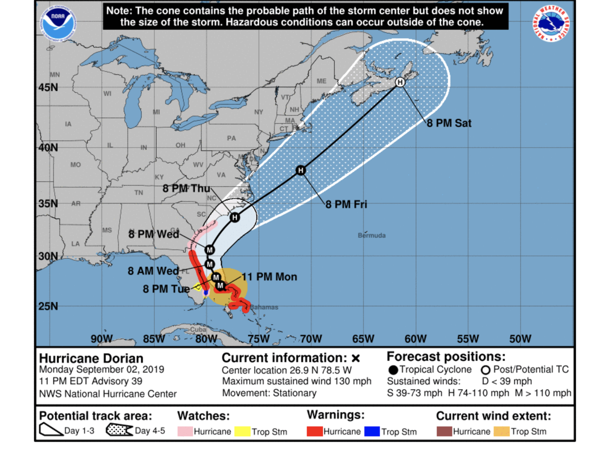
Hurricane Dorian weakened to 130 mph — a low Category 4 — the evening of Monday, Sept. 2, and was still expected to track parallel to Florida and remain offshore, according to the National Hurricane Center's storm update message posted at 11 p.m.
As of 11 p.m., Dorian was over the Bahamas, with its westernmost bands causing gusty winds in southeast Florida.
"The major hurricane has been stationary much of the day," the NHC message states. "The reason the cyclone has moved very little is because it is caught in weak steering currents between high pressure ridges to its east and northwest and a trough to its north. This weak flow should result in a very slow and likely erratic northwest drift through at least early Tuesday."
Then the storm is expected to gain some speed and move north on Wednesday, and northeast on Thursday and Friday, according to the NHC.
"The NHC track forecast remains consistent and continues to show the core of Dorian offshore, but dangerously close to the east coast of the U.S. from Florida to North Carolina during the next 3 days or so," the message states. "This track forecast is largely an update of the previous one and it is in good agreement with the various consensus models. Users are reminded that the hurricane is not a point, and that life-threatening storm surge and hurricane-force winds extend far from the center."
Dorian is expected to weaken over the coming days, but will still be a powerful hurricane as it passes Florida and is expected to cause life-threatening storm surge and hurricane-force winds, and potentially flooding.
"Water levels could begin to rise well in advance of the arrival of strong winds," the NHC message states. "Residents in these areas should follow advice given by local emergency officials."


