
- June 24, 2026
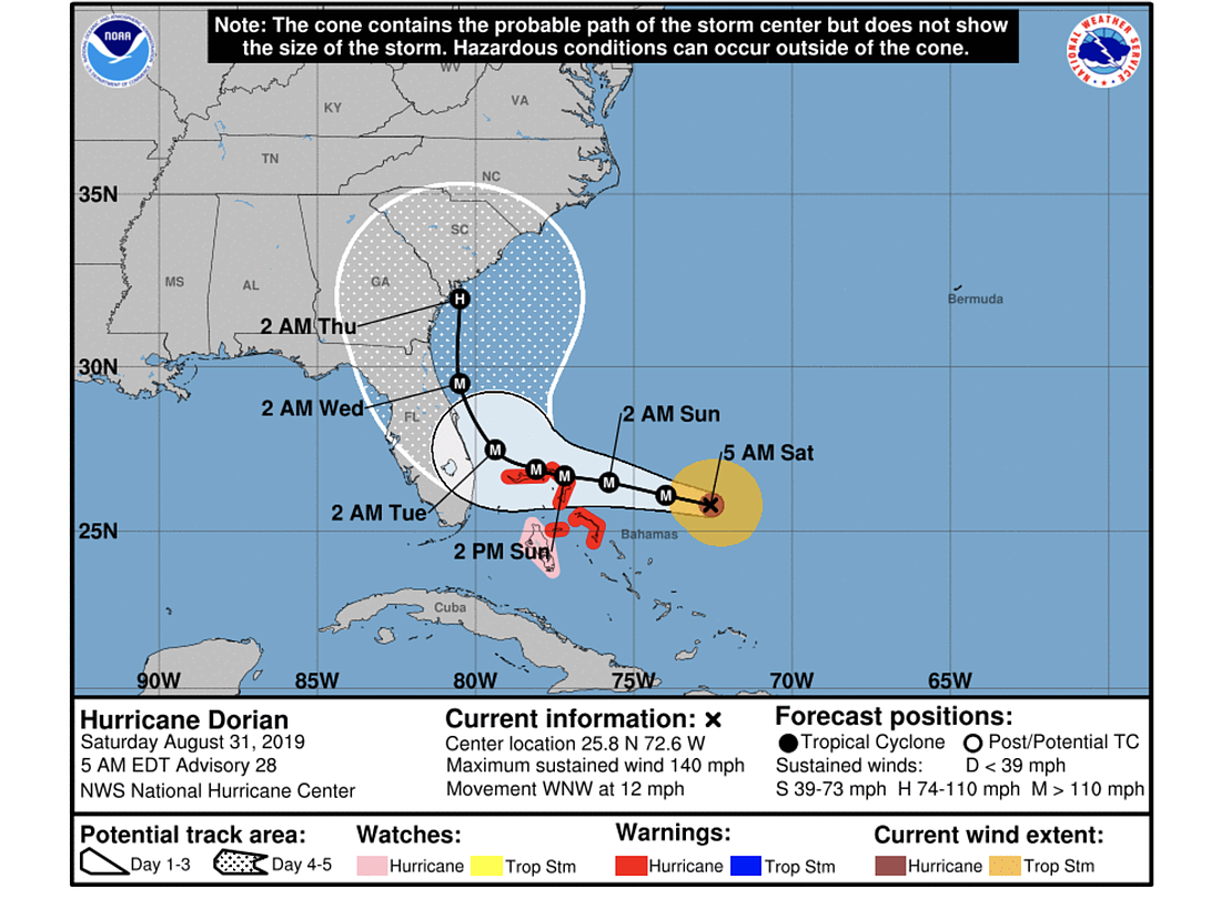
Hurricane Dorian may remain off the coast of Florida, avoiding landfall in the state and passing by the Volusia/Flagler area at around 2 a.m. Wednesday, according to the National Hurricane Center's storm update message the morning of Saturday, Aug. 31. But models still conflict.
"The global models the NHC normally uses, along with the regional HWRF and HMON models, have made another shift to the east to the point where none of them forecast Dorian to make landfall in Florida," the NHC message states. "However, the UKMET ensemble mean still brings the hurricane over the Florida peninsula, as do several GFS and ECMWF ensemble members. ... It should be noted that the new forecast track does not preclude Dorian making landfall on the Florida coast, as large portions of the coast remain in the track cone of uncertainty."
Dorian, currently a Category 4 hurricane with winds of 140 mph, could still cause major impacts in Florida even if it doesn't make a direct landfall. Wind speeds are expected to reach 145 mph over the next 36 hours, then weaken to 130 miles per hours over the following two days. Dorian is expected to still be a major hurricane as it passes Volusia and Flagler.
The storm has a 10-15-mile-wide eye and is expected to be steered westward by a subtropical ridge for the next 48 hours and continue to slow as it approaches the Abacos and Grand Bahama. The northwestern Bahamas are under a hurricane warning.


