
- June 9, 2026
The National Weather Service has extended a severe thunderstorm watch, formerly in effect until 2 p.m., until 5 p.m., in Flagler County.
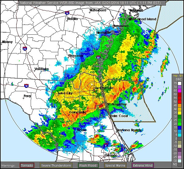
This watch includes six Florida counties.
"A line of showers, rain and thunderstorms extends from Gainesville to Jacksonville and has slowed down its forward motion," according to Bob Pickering, Flagler County's emergency management technician. "However isolated, thunderstorms have popped up ahead of the line and these are the ones that have a better chance of producing severe weather. A funnel cloud and one-inch hail was reported at 12:10 p.m. in Putnam County, from one of these isolated storms ahead of the line. That storm has moved north into St. Johns County."
Pickering also advises owning weather-alert radios.
"If you observe any weather-related damage, funnel clouds, winds over 40 mph, hail, etc., please contact Emergency Management (at 313-4200) or the Dispatch Center," he added.
Pickering is available for questions, at 931-5077.
To sign up for the CodeRed emergency-notifcation platform, CLICK HERE.


